To help with revision, here are the video hyperlinks we used in the lesson
...
...
Wednesday 21 June 2017
Thursday 8 June 2017
Map docs
You can find many more detailed guides online, below are the materials we have used in lessons:
A short additional test you can use:
...
Os key reference from DB3igs
A short additional test you can use:
...
Wednesday 12 April 2017
Monday 3 April 2017
Luxembourg City site and situation
The task:
Common issues!
KEY ISSUES?
SAMPLE QUOTES
I would only use the shortest of these in an essay, but always state where you get information from, eg: the city was on a 'major miltary route' which linked what would become Germany and France (Wiki). Indenting quotes as I have below also helps to set them out very clearly.
WHAT EXCELLENT LOOKS LIKE
This is what an outstanding report looks like (by Georgia and Siddarth), with another (by Ronan) which is very good on explaining the situation, focussing on the trade links:
LAURINE's
Common issues!
KEY ISSUES?
- Many were simply too brief to provide an adequate description or explanation
- Maps and images were often not referred to in text - and even when they were, there were usually obvious additional points (evidence!) to make
- Map details, such as height and distance to establish steepness (with a pic of contour lines from the site!), would be very useful
- Many of you barely explained how a defensive site actually functions!
- Some didn't identify it primarily as a defensive site!
- Trade links (and detail of what was traded, with whom!) is a key factor in the situation (see Ronan's mostly excellent analysis), along with the water, woods, other building/trade-able resources, suitability for farming, and those defensive features
- Use of geographical terms was inconsistent - for example, the MEANDER feature is an important one!
- PLAGIARISM - its not so much that some of you were trying to cheat (that won't matter as you get to GCSE, A-Level and beyond, which is why its a very important lesson), but its not clear enough where you got information from, and writing too often clearly was not in your own style or words. Here's an example - do you think a Y7 student is likely to write this? 'Luxembourg city is a forested highland region which is incised by the deep valleys of a river network organised around the river Sûre.'
SAMPLE QUOTES
I would only use the shortest of these in an essay, but always state where you get information from, eg: the city was on a 'major miltary route' which linked what would become Germany and France (Wiki). Indenting quotes as I have below also helps to set them out very clearly.
The history of Luxembourg properly began with the construction of Luxembourg Castle in the High Middle Ages.... Around this fort, a town gradually developed, which became the centre of a small but important state of great strategic value to France, Germany and the Netherlands. Luxembourg's fortress, located on a rocky outcrop known as the Bock, was steadily enlarged and strengthened over the years by successive owners. Some of these included the Bourbons, Habsburgs and Hohenzollerns, who made it one of the strongest fortresses on the European continent, the Fortress of Luxembourg. (from Wiki)
The ancient Saxon name of its capital city, Lucilinburhuc (“Little Fortress”), symbolized its strategic position as “the Gibraltar of the north,” astride a major military route linking Germanic and Frankish territories. (from Britannica)
The nation's links with Germanic culture strengthened during the five centuries of independence, especially in the fourteenth century, when Luxembourg's dukes also ruled the German-centered Holy Roman Empire and the national territory extended as far east as the present-day Czech Republic. (from everyculture.com)
WHAT EXCELLENT LOOKS LIKE
This is what an outstanding report looks like (by Georgia and Siddarth), with another (by Ronan) which is very good on explaining the situation, focussing on the trade links:
LAURINE's
Water cycle, urbanisation and global warming
There’s another story to tell about climate change. And it starts with water
https://www.theguardian.com/commentisfree/2017/apr/03/climate-change-water-fossil-fuel?CMP=Share_AndroidApp_Blogger
Monday 20 March 2017
EROSION weathering
You can find good detail on this online; here are 2 resources, one very simple, basic and short, and another which is longer and more complex:
ONEGEOLOGY.ORG - SIMPLER

31-slide Powerpoint - more detail
SHORT VIDEO (5:02) - simple
ONEGEOLOGY.ORG - SIMPLER

31-slide Powerpoint - more detail
SHORT VIDEO (5:02) - simple
Thursday 2 March 2017
RIVER PROCESSES crossword
Before starting a new assignment on flooding, a chance to consolidate your grasp of key terms.
Your task is to complete this crossword - you will have a paper copy of the clues, and should also write answers on this. On the crossword site, click return when you've typed a full answer - if its correct it will go green!
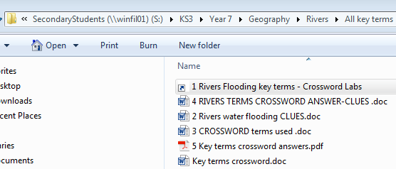
You have the option of getting some help with the clues - in the Y7 Geog folder 3. Rivers and flooding. You can copy the whole folder, so you can access this as a revision aid at any time.
Your task is to complete this crossword - you will have a paper copy of the clues, and should also write answers on this. On the crossword site, click return when you've typed a full answer - if its correct it will go green!
You have the option of getting some help with the clues - in the Y7 Geog folder 3. Rivers and flooding. You can copy the whole folder, so you can access this as a revision aid at any time.
EXTENSION: If/when you complete the crossword, make your own mini-quiz using PowerPoint, with between 3-5 questions, at least 1 of which should feature a diagram or photo/s, on any aspect of the water cycle, rivers, flooding. Use the animation tool so that the answer appears only by clicking after the question.
Once complete, leave on your screen and go have a try on someone else's mini-quiz.
Double-click the shortcut to access the crossword. You can copy this folder
Subscribe to:
Posts (Atom)